KaleidEO Unveils a High Resolution Multispectral Payload Delivering the Largest Area Coverage from India
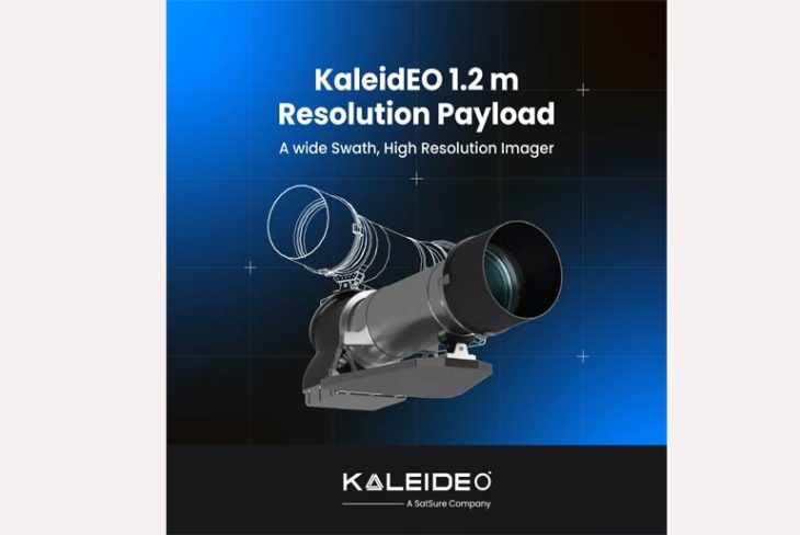
KaleidEO Space Systems, a subsidiary of SatSure Analytics India Pvt Ltd, announces the launch of its high-resolution, optical, multispectral payload. The payload is a one-of-a-kind wide swath imager, designed to maximize the area coverage while maintaining higher resolution of image captured. The payload will be able to deliver near 1 meter Ground Sampling Distance (GSD) while covering a 65 km swath. GSD refers to Ground Sampling Distance which is the distance between two consecutive pixel centres measured on ground from air or space.
This development comes in after it successfully completed the aerial testing of the scaled down prototype version of the optical EO (earth observation) payload which captured images at 16 centimeters spatial resolution.
The payload offers at least 15x more area than most payloads in the market today. Presently, such resolution in the industry is achievable with a swath coverage of up to 15 km. KaleidEO’s payload will be able to capture the entire Bangalore city in a single pass.
The industry presently faces a challenge of getting high-resolution images along with high coverage. In order to get a higher resolution image, satellites need to reduce its swath or area coverage, making them almost inversely proportional to each other. KaleidEO’s payload configuration is designed to enable higher assurance on quality of insights derived and efficiency improvement through automation. It will also eliminate the need for depending on the conventional process of stitching multiple images together for capturing a large area.
Currently at Technology Readiness Level 6 (TRL 6), the payload will have six bands, viz., Red, Green, Blue, Near Infrared, Red Edge and PAN. Availability of the data in multiple bands allows for identifying and analyzing diverse features on ground such as vegetation health condition, moisture condition, water body and soil features, which otherwise are not visible to naked eyes.
The unique combination of large swath, high resolution and multispectral bands will allow improved identification of objects and features on earth. This enables versatile use applications, supporting large area analytics applications in the areas of crop monitoring, forest health assessment, urban planning, infrastructure asset monitoring, and strategic applications. Apart from this, the payload also employs forward motion compensation and half pixel shift methodology for super-resolving captured images, further improving detail and accuracy.
Speaking about this milestone, Arpan Sahoo, Chief Operating Officer and Co-Founder, KaleidEO said, “The KaleidEO payload emphasizes on a ‘Demand First’ approach unlike the traditional ‘Supply First’ approach. We configured the payload specification to the industry’s need for large area acquisition and automated analytics at scale. We have received positive responses and inquiries from the industry and are open to exploring opportunities to customize the payload to meet specific requirements, as the payload Series offers both COTS and bespoke solutions.”
Commenting on the development, Akash Yalagash, Chief Technology Officer and Co-Founder, KaleidEO said, “KaleidEO’s 1.2 m payload is the first in the official launch of our payload series. The successful demonstration of half pixel shift and forward motion compensation has validated our plans to accelerate to a space flight version of the payload. We are also working on a sub-meter payload which is currently at TRL-3 and are in parallel exploring bespoke requirements from clients for the same.”
